📥 Download FREE desktop wallpaper
🖼️ View artwork details & shipping
📸 Request a free wall preview
“Broken Palace”
Description:
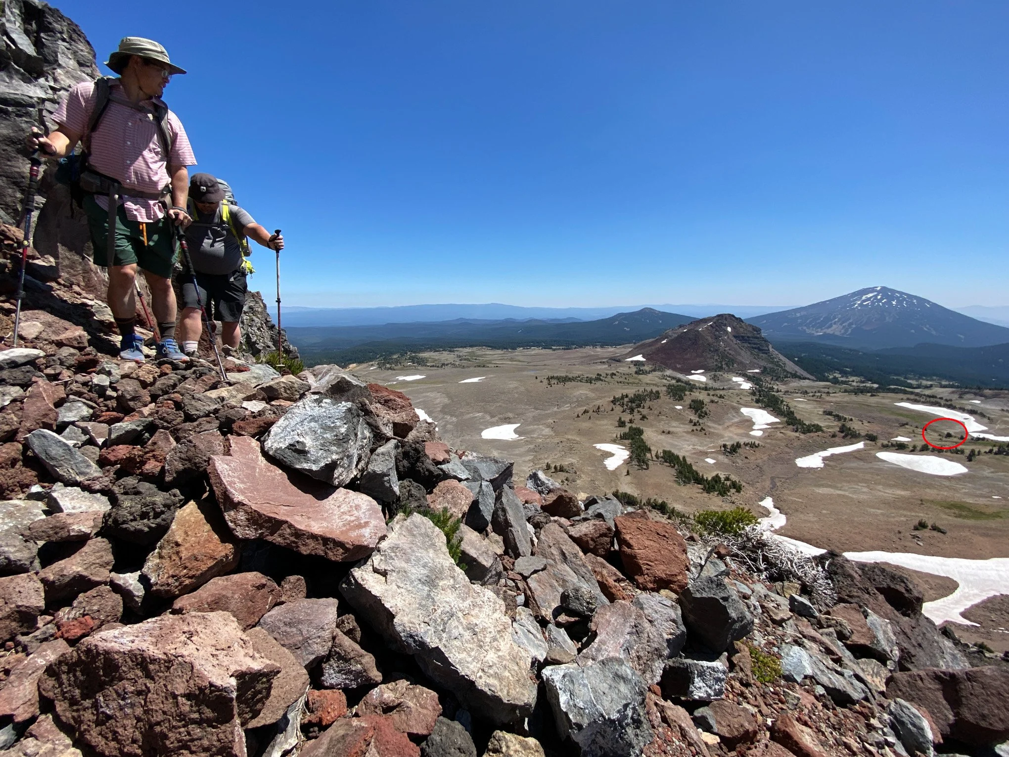
From the Broken Top Loop, this view captures Mount Bachelor, No Name Lake, Broken Top, and South Sister. Broken Top’s rugged form reflects millions of years of volcanic activity followed by intense glacial erosion. The turquoise basin of No Name Lake marks the cirque left behind by retreating alpine ice.
Story:
From left to right is Mount Bachelor, No Name Lake, Broken Top, and South Sister. I reached this viewpoint several hours into a backpacking trip with a group of friends. They pressed on while inspiration caught hold of me, and I stopped to take in the views before capturing this panoramic image.
I think this is arguably the best view along the entire 25-mile Broken Top Loop. At roughly 8,000 feet, the world opens in every direction. To the north and south, you can trace the spine of the Cascades for hundreds of miles: from Washington State’s Mount Adams all the way toward the California border. Due west, the snow-capped Three Sisters, the iconic stratovolcanoes of the central Cascades, feel close enough to touch. Turn east, and Oregon’s high desert stretches out farther than the eye can follow, fading slowly into a distant blue haze.
Beneath your feet, as you wander the ridgeline, millions of shattered rocks shift and clatter with every step. They sound like broken pottery, their grayish-red fragments scattered from some long-forgotten kiln. That color, and their splintered form, are traces of the violent volcanic forces that shaped this terrain over millions of years.
Up here, surrounded by jagged stone, lingering snowfields, and the sharp silence of high elevation, it feels like standing inside a ruined palace built by the gods of fire and ice.
-BAP
Location:
Broken Top Loop Trail
Oregon
44° 5' 6.8'' N, 121° 41' 10.8'' W
Google Map Link
Time: 15:55 PDT
Date: July 23rd, 2021
Camera & Settings:
Panorama (17 photos)
Nikon D800E, NIKKOR 24-70mm f/2.8G, CPL Filter, Tripod
ISO 400, 24 mm, f/16, 1/200 sec
📥 Download FREE desktop wallpaper
🖼️ View artwork details & shipping
📸 Request a free wall preview
“Broken Palace”
Description:
From the Broken Top Loop, this view captures Mount Bachelor, No Name Lake, Broken Top, and South Sister. Broken Top’s rugged form reflects millions of years of volcanic activity followed by intense glacial erosion. The turquoise basin of No Name Lake marks the cirque left behind by retreating alpine ice.
Story:
From left to right is Mount Bachelor, No Name Lake, Broken Top, and South Sister. I reached this viewpoint several hours into a backpacking trip with a group of friends. They pressed on while inspiration caught hold of me, and I stopped to take in the views before capturing this panoramic image.
I think this is arguably the best view along the entire 25-mile Broken Top Loop. At roughly 8,000 feet, the world opens in every direction. To the north and south, you can trace the spine of the Cascades for hundreds of miles: from Washington State’s Mount Adams all the way toward the California border. Due west, the snow-capped Three Sisters, the iconic stratovolcanoes of the central Cascades, feel close enough to touch. Turn east, and Oregon’s high desert stretches out farther than the eye can follow, fading slowly into a distant blue haze.
Beneath your feet, as you wander the ridgeline, millions of shattered rocks shift and clatter with every step. They sound like broken pottery, their grayish-red fragments scattered from some long-forgotten kiln. That color, and their splintered form, are traces of the violent volcanic forces that shaped this terrain over millions of years.
Up here, surrounded by jagged stone, lingering snowfields, and the sharp silence of high elevation, it feels like standing inside a ruined palace built by the gods of fire and ice.
-BAP
Location:
Broken Top Loop Trail
Oregon
44° 5' 6.8'' N, 121° 41' 10.8'' W
Google Map Link
Time: 15:55 PDT
Date: July 23rd, 2021
Camera & Settings:
Panorama (17 photos)
Nikon D800E, NIKKOR 24-70mm f/2.8G, CPL Filter, Tripod
ISO 400, 24 mm, f/16, 1/200 sec

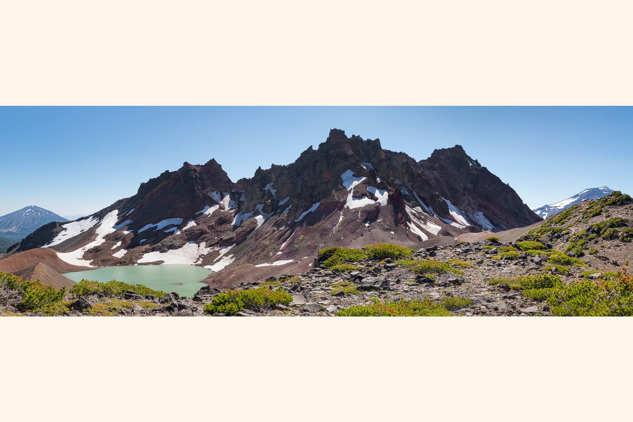 Image 1 of 4
 Image 2 of 4
 Image 3 of 4
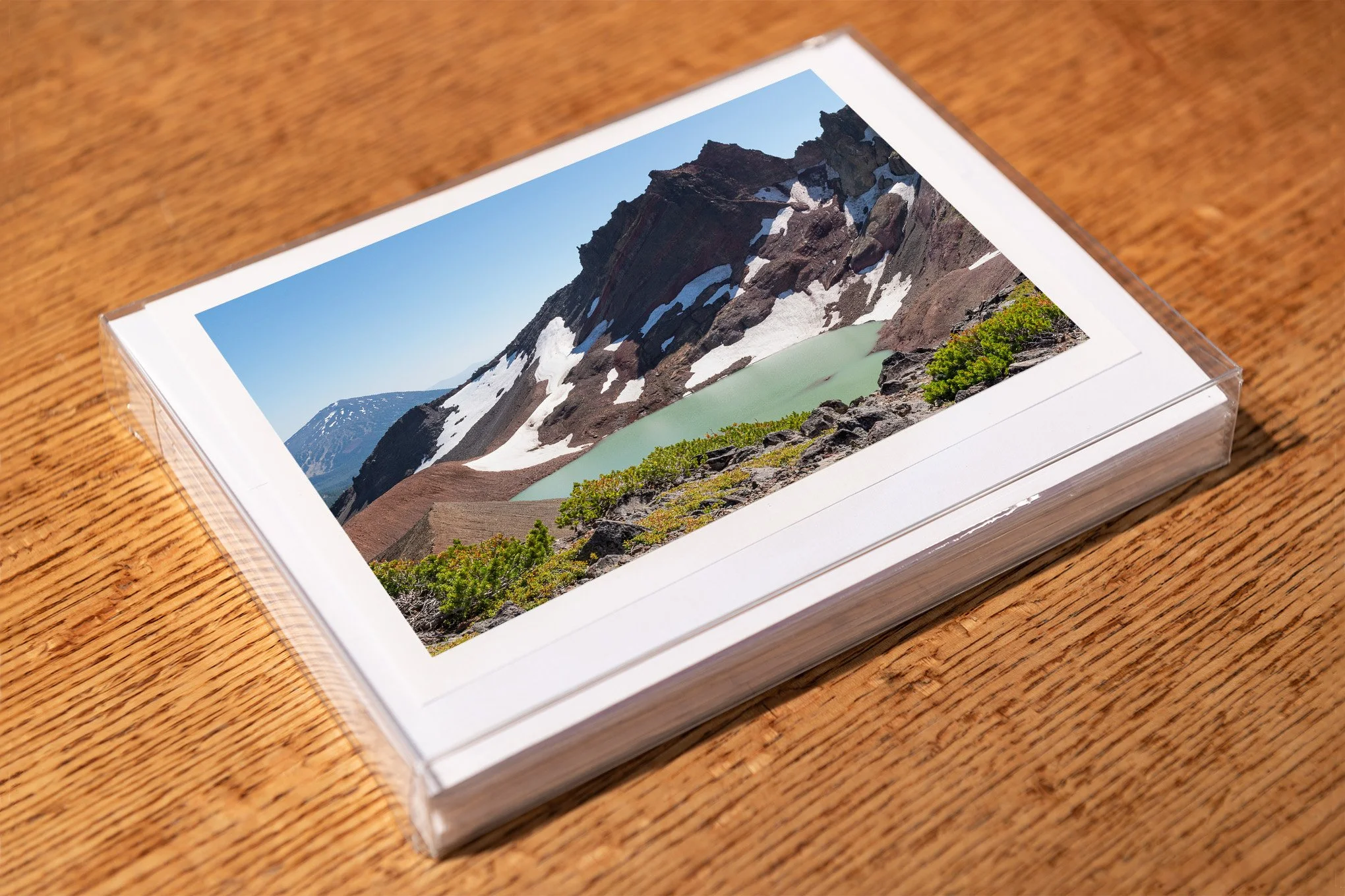 Image 4 of 4